Monday, March 26, 2007

Sticking it to The Man at Fremont Older - Fri Mar 23

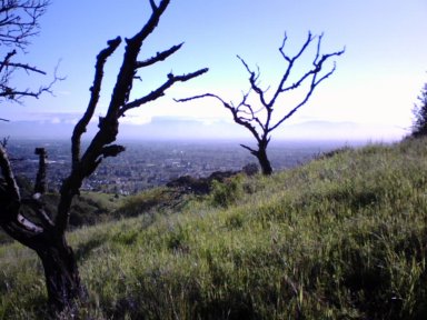
Took another Friday afternoon (evening, actually) walk with Raleigh up to Fremont Older.  We had a beer bash at work so I could get out reasonably early again.  I remember now that the week before Kai let us out early (he was heading out on vacation and was feeling generous, I suppose).

We did just about the same hike we had done Wed morning.  Well, not quite.  I headed up the hillside (cross country) from the bend in the road near the Creekside trail (following a firebreak, so it isn't like I'm trodding on untouched soil or anything).  At the top, Raleigh picked up the scent of something and we went across the grassy hillside across the Haystack trail (fire road).  There was a coyote sitting in the grass there.  They sometimes give Raleigh fits because he doesn't quite know what to make of them.  They look like dogs, but probably don't smell like normal dogs.  And they aren't with any people.

Anyway, we headed back over to the road.  A passing bicyclist remarked that the ranger was parked on the road up by Hunter's Point and he might write me a ticket for going off-trail.

Imagine that!  I told the bicyclist that they'd have to drag me kicking and screaming out of my land (or my portion of the public's land; my portion being that part which is well off the trail).  Actually, I checked the sign on the way out and it said that bicyclists and equestrians must remain on designated trails.  Which means, to me, that us folks on foot can go wherever the hell we please (even if it does mean regretting it a week later when the poison oak is at its worst).

Well, I headed towards the ranger but before getting there, I turned off on a short spur road, went cross country (take that!) up to Hunters Point, then down and around, returning back by the road and Creekside trail.

Arrived back at the car at sunset minus 30 seconds.  We're getting pretty good at that.

I've been studying the map and am planning a "Compleat Fremont Older" expedition which will have us covering every inch of trail in one outing (plus maybe Parker Ranch Trail to boot).  There are a maze of trail in this park!  Could require lots of advance planning to make sure we don't miss any.  Could be a good candidate for a moonlight, covert operation (as this park definitely closes after dark).

I do believe one could park at the foot of Parker Ranch Trail withnodifficulty, however...watch for an update soon.  Full moon is on April 2.


Hike totals: 2 miles, 200' elevation gain
2007 totals: 106 miles, 24,600' elevation gain

Good Morning Silicon Valley - Wed Mar 21

I took Raleigh out for a morning walk to Fremont Older on Wednesday.

We rarely get out in the morning, even on weekends.

It turned out to be a much better time to visit Fremont Older.  Seems everybody else was going to work or something.

Plenty of free parking.  Went up the Cora Older trail (which I usually avoid due to crowds).  Looped around Hunter Point and returned via Creekside Trail.  It was another beautiful spring day (that string of good weather ended today; I'm looking out the window at the rain right now).

It was kind of nice to look out on the valley in the morning light.  I think retirement might not be so bad...


Hike totals: 2 mi, 200' elevation gain
2007 totals: 104 miles, 24,400' elevation gain

Mt Eden Loop - Sun Mar 18

Sunday evening rolled around and I felt compelled to go out once again (third time on this weekend).

Took the short drive to Mt. Eden trailhead and took the "normal" route: up the main "trail", then up the ridgeline to the upper road, up that to the deadend at the vineyards, then back down the backside (following the private horse trails which they graciously open to public passage - thank you kind landowners).

Nothing of note to report, though.  It was late so we hustled down, then back up to the car (which is a bit disheartening) to finish before dark.  Only saw one other person: a homeless-looking kind of guy laying in the sun at the top of one of the switchbacks.  He would have kept me there till dark listening to his tales (about dogs) if I had let him.  Which I didn't :-).

Hike totals: 2 miles, 500' elevation gain
2007 totals: 102 miles, 24,200' elevation gain

Harver Bear Ranch Outlaws - Sat Mar 17

For some reason, I got it in my head that the new Harvey Bear Ranch county park (Santa Clara County) allowed dogs.  I don't know why.  But I planned a trip there, went (with Raleigh), and returned.  It wasn't till afterward that I noticed (researching another hike) that this park actually doesn't allow dogs on the trails.

Oops.

No matter.  We only saw 2 other people (but we did run into them twice during the afternoon).  Otherwise, we had the park to ourselves (aside from a couple people with horses and one guy with a llama in the parking lot).

The bottom line: I think they only care about the dogs in parks where there are people or if the dogs cause a problem.  Kind of like smoking pot, I suppose.

It continued to be a gorgeous spring weekend.  Warm and sunny with lots of poppies blooming.  I have lots of pictures which I'll upload later.

The hiking there is mediocre.  The lower reaches of the park are open and I'm sure very hot in the summer.  The ridge up at the top, above Coyote Lake, is nice walking with lots of oaks and gradual ups and downs.   This would be a nice up and back hike from Coyote Lake parking (thus avoiding some of the exposed, lower western-facing slopes and much of th climbing).

After we got to the top of the ridge, I decided to climb to the highpoint at the northern end of the park (there's a similar hill at the other end which we didn't get to).  At the top are piled a bunch of large rocks, which I had to scramble on to get to the highest point (which I just had to do :-).

Jumping down off the rocks, I heard what I immediately thought must be a rattlesnake!  It rattled and rattled and rattled for what seemed like minutes.  I stood still looking for it.  I wanted to take a picture and it didn't sound close enough to strike.  I never did figure out where it was.  As I retreated, it did another long rattle.

So I call that hill Rattlesnake Hill.

We headed south until it was time to head back.  Given more time, it would be nice to hike that whole ridge which would make about 8 miles or so up and back.  We doubled back a ways and headed downhill.  We had to chase some cows out of our path.  Got back to the car at sunset, exactly (as usual).

This hike puts me at the 100 mile mark for 2007!

Hike totals: 9 miles, 1500' elevation gain
2007 totals: 100 miles, 23,700' elevation gain

Spring has Sprung at Fremont Older - Fri Mar 16

Took off from work early on this Friday (I don't remember why; mostly fed up with crap going on there, probably :-).

I decided to head up to Fremont Older with Raleigh.  I don't usually get out on weekdays.  The first problem was that they were working on the railroad crossing at Prospect Rd.   I had to find the detour through the Seven Springs subdivision.  That wasted precious moments before sunset.

Then, the parking lot was still crowded.  Bad enough to find it that way on a weekday.  But with the main road blocked?  Sheesh.

We did get a spot and headed up the road.  Took the creekside trail cutoff, as usual, then got to the fire road through the grassy hillsides.  Poppies everywhere.  It was sunny and warm.  The grass was green.  Raleigh had a great time eating it.

It was already getting late so we just went up to the Hayfield Tr turned left, went a ways, then cut back down to the fire road leading back to the Creekside Tr.  Saw a few deer on the hillside above the trail where they usually assemble.  Nothing else of note.

But a nice outing to close out the work week.

Hike totals:  2 mi, 200' elevation gain
2007 totals: 91 miles, 22200' elevation gain

Off Trail at Mt. Eden - Sat Mar 10

A week later I went out for a short jaunt at Mt Eden Trail (part of Stevens Canyon County Park, I think).  There is a parking area at the top of Mt. Eden Rd in Saratoga.  There's one trail which connects with some private horse-riding trails on the back side.

This time I went up the normal road then started down at the second "junction" towards Stevens Creek.  You can go all the way to the creek if you cross Stevens Canyon Rd at the end.

I was with Raleigh but we stopped just short of the road.  It's a bit of a scramble down to the road for no good purpose except to let Raleigh get a drink, but that wasn't necessary today since we were just out for a short walk and it was pretty cool (and late).

On the way back we scrambled up the wooded slope to the right of the road down near the bottom.  The hill isn't too steep there and the understory not at all brusy (i.e., no poison oak threat).

We followed a gradual creekbed up, then contoured up to the top of the ridge back towards Stevens Creek.  We then followed the ridge up until the way started to get brush-filled again.  We picked up a good use trail that went back towards the south and headed down when we reached the creekbed we had started up.  We were much higher at this point and it took a while to get back to the road where we had left it.

By then it was getting kind of dark.  We returned the same way we came, ending up at the car at sunset, more or less.  Fifteen minutes later we were back home.

I'm thinking we'll head up this way again someday and try to follow that ridge up higher to see what's up there.  Probably end up in somebody's backyard; maybe one of the vineyards that are up at the top of the normal trail there at Mt. Eden.

Hike: ~2 miles, ~1000 elevation gain
2007 Totals: 89 miles, 22,000' elevation gain

My Mission Peak Mission - Sat Mar 3

Sat Mar 03

Its been a while since I posted.  But not since I've been out on the trails.  I've got 7 trips of various lengths to report on (some are even interesting).

Starting with this one...

...the March W.A.I.S.T. Management hike was way back on Mar 3rd.  After some wrangling over destination for the March hike, many of us ended up at Mission Pk to climb by moonlight (it was a full moon that night).

Participants: me, Steve, Michael, Jay, Ed, Barbara, Alberto, and Sarah.  Barbara dropped out after a mile or so.  Too much climbing and distance for her.  Us young -uns (I jest, Barbara's birthday is one day before mine, or something like that :-) didn't know any better, apparently.

I was out to complete my long anticipated "triple:" climbing all three of Mission Peak, Mt. Allison, and Monument Peak, the 3 highest points on the ridge above Milpitas and Fremont just south of the Sunol "pass" (do they call that a pass?  It's definitely the "Sunol grade" when you're climbing it on 680).

See my previous exploits in the same area twice in the previous months, recorded in previous entries to this humble journal.  I remarked in the last one that it would have been nice to have climbed Mission Peak as well on that trip.  So I had resolved to give it another go.

The mission was ambitious.  Plus, it was by moonlight.  The parking lot is posted as being open till 10pm.  I notice that the park web site says till dusk, however.  So go after sunset at your own risk.

The hike was pretty uneventful.  We only got lost once.  Well, Ok; maybe twice.  But we weren't really lost.  I missed the turn towards Monument Peak coming down from Mt. Allison (due to poor lighting and distractions shooting the breeze with other hikers).  We had to go cross country a couple of hundred yards to pick up the road heading over to Monument Peak.  No biggee.

Coming back, I erred and led us downhill on the road to Mt. Allison.   That was just a brain fart.  I thought the road junction there was a different junction and insisted on turning, even though it was at the wrong place.  This one took us downhill a couple hundred feet.  Eventually, I went around the ridge to the left to get a view of Mission Peak.  After some scrambling up to the top of a rocky hill, above a steep rocky canyon to the NW, I called out for everybody to turn around and rejoin me up at the top.

Things were uneventful from that point on.  We got to the top of Mission Peak just before 9pm.  Wanting to avoid a ticket for being parked in the lot past closing, I jogged pretty much all the way down (3 miles) with Steve.  We got there after about 45 minutes to meet Barbara and then wait for everybody else.

We did enjoy a cold beer while waiting (that's probably illegal, too).  Sarah and Alberto were the last to arrive.  We spoke to Anne by phone in order to cancel the next days outing (what would have been the real WM hike).  She gets full credit for christening this the "Mission Peak Mission."

Mission Accomplished!

Hike totals: 9 mi, 3000' elevation gain
2007 totals: 87 miles, 21,000' elevation gain